

Driver’s Desk
GLONASS vs GPS: Which Is Better for Tracking?
The parking space is empty, but your phone still shows the last place you left the car. You call nearby contacts, check the surrounding streets, and replay the moment you last saw it. In a vehicle theft, uncertainty costs time. A tracker that can't obtain a dependable position in a city, garage, or area affected by interference may leave you with an old location when you need a current one.
That's why the GLONASS vs GPS question isn't really about choosing a winner. It's about whether your tracker can use the strengths of both satellite systems when visibility becomes difficult. GPS remains the familiar global standard, while GLONASS can add useful coverage and geometry, particularly at higher latitudes. For vehicle security, a receiver that combines constellations generally gives you a stronger foundation than one that relies on a single system.
| Tracking consideration | GPS | GLONASS | Practical vehicle-security meaning |
|---|---|---|---|
| Operational role | Global civilian navigation standard | Russian-operated global navigation system | Both can support vehicle positioning |
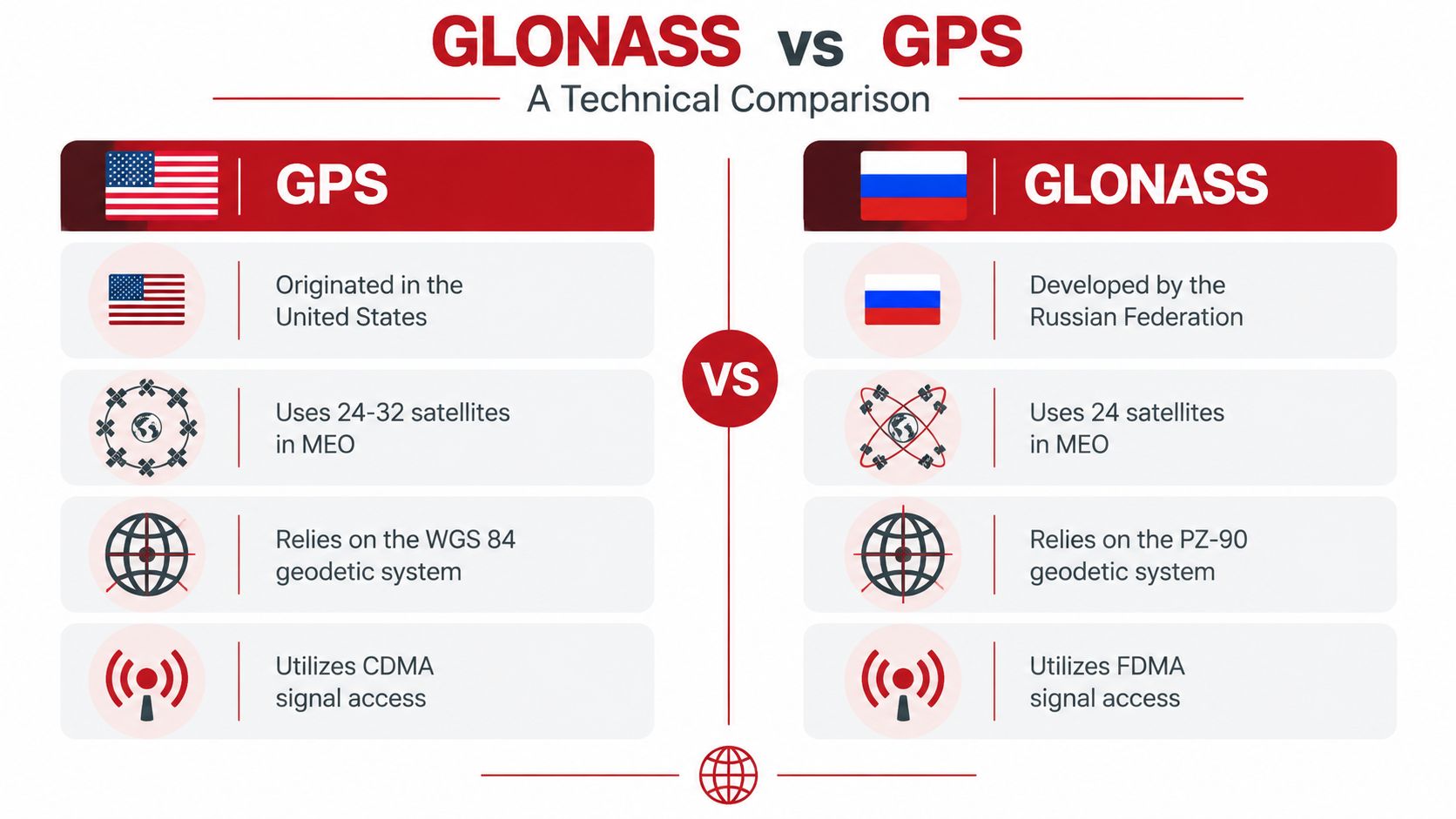
| Orbital arrangement | Six-plane MEO constellation, about 20,200 km altitude, 55° inclination | Three-plane MEO constellation, about 19,100 km altitude, 64.8° inclination | GLONASS can improve visibility at higher latitudes |
| Signal design | CDMA on L1, L2, and L5 | Historically FDMA on L1 and L2 | Receiver design and interoperability differ |
| Standalone civilian performance | Commonly about 4.9 m unaugmented | Commonly about 5 m unaugmented | Neither system alone guarantees sub-meter tracking |
| Most useful configuration | Combined with other GNSS | Combined with other GNSS | Multi-constellation reception improves availability and resilience |
Your Car Is Gone What Happens Next
The first step is to confirm whether the vehicle has moved. Check the tracker's latest notification, open the current location, and compare it with the last known trip. A movement alert, engine-start alert, towing alert, or device-disconnection alert can tell you whether you're dealing with theft, an authorised driver, a mechanic, or a recovery vehicle.
The second step is to judge the quality of the location, not just the presence of a map pin. A position in an open field may be clean and stable, while a point between tall buildings can shift because signals are blocked or reflected. If the car is inside a structure, the last outdoor position and the time of the last update may be more useful than a weak indoor reading.
For owners who want a system built specifically around vehicle movement and location monitoring, a dedicated car tracking system can combine satellite positioning with cellular communication and app-based alerts. That matters because a tracker has two separate jobs. It must calculate where the car is, then transmit that information to you.
Start with the last reliable position
Record the time, address, direction of travel, and any recent alerts. Share those details with the police rather than relying on a screenshot alone. A route history can help show where the vehicle travelled before it stopped reporting, while an alert history can reveal possible tampering or a power interruption.
Treat satellite visibility as a changing condition
GPS and GLONASS receivers don't perform in a vacuum. The vehicle's roof, nearby buildings, metal structures, trees, underground levels, and deliberate interference can all affect reception. A tracker that can listen to both constellations has more opportunities to build a position when one system's satellite geometry is unfavourable.
The practical question is simple: which setup gives you the highest chance of receiving a usable update when the vehicle is no longer where it should be? In most difficult environments, the answer is multi-constellation reception, supported by reliable cellular connectivity and a tracker designed for continuous vehicle use.
The Titans of Satellite Navigation
A stolen car can disappear from a clear suburban road into a concrete parking structure within minutes. The tracker then depends on which satellite signals remain usable, how quickly it can calculate a position, and whether it can report that position through the cellular network. Satellite navigation is therefore part of the recovery chain, not just a specification on a product box.
GPS, the Global Positioning System, was developed by the United States and became the main civilian reference for satellite navigation. It reached a major operational milestone in 1993, when it achieved a full 24-satellite constellation. In October 2011, that orbital constellation enabled full global coverage, helping explain GPS's dominant role in civilian navigation. Its operational history is documented in this overview of the Global Positioning System.
GPS was designed to provide positioning, navigation, and timing worldwide. A receiver measures satellite signals and compares their timing to calculate its position. Drivers see the result as a blue dot, turn-by-turn directions, or a tracker location. Underneath, the system depends on precise timing, orbital data, an antenna, and receiver processing.
GLONASS, the Global Navigation Satellite System, was developed by the Russian Federation as a counterpart to GPS. It serves the same broad purpose, providing satellite-based positioning and timing, but follows a different operational and engineering path. Its deployment history was less even and relied on Russian-managed timing and orbital infrastructure rather than one uninterrupted global rollout.
Two systems, different strategic foundations
For vehicle security, the value of two systems is practical. A receiver can combine signals from separate constellations and work with the satellites visible at that moment. It does not need to choose a preferred system. It needs enough usable measurements to locate a vehicle before conditions change.
GPS became widely familiar through its coverage, ecosystem, and broad receiver support. GLONASS uses a different orbital distribution, with stronger visibility potential at higher latitudes. That can matter for a vehicle operating in northern regions. In a dense city, however, buildings may block satellites from either constellation, while underground structures and interference can disrupt both.
Practical rule: Treat GPS and GLONASS as complementary positioning sources, not competing badges on a product box.
Modern receivers often combine the two systems. That pairing can help them obtain a position fix sooner and, in some cases, produce accuracy within about two meters, according to the GPS reference above. Actual performance still depends on antenna quality, sky visibility, receiver processing, cellular reporting, and the vehicle's surroundings.
For recovery, the relevant question is whether the complete tracker can keep producing useful updates as the car moves through urban canyons, open fields, high-latitude areas, or locations affected by interference. Having both GPS and GLONASS gives the receiver more satellite geometry to work with when a single constellation leaves too few reliable signals.
GLONASS vs GPS A Technical Deep Dive
The choice between GLONASS and GPS becomes practical when a vehicle disappears from view. Satellite height, orbital inclination, and signal design determine how many usable measurements reach the tracker, how the receiver processes them, and whether it can calculate a dependable position before the car moves again.
Orbital geometry and visibility
GLONASS operates in a three-plane medium Earth orbit constellation at about 19,100 km altitude, with an inclination of 64.8°. GPS uses a six-plane medium Earth orbit constellation at about 20,200 km altitude, with a 55° inclination. These figures are described in the GLONASS technical explanation.
Inclination indicates how far an orbital path extends toward the poles. GLONASS's wider inclination can provide stronger high-latitude visibility than GPS, giving a tracker more satellite positions to assess in northern regions. That advantage is more relevant for a car operating in an open northern area than for one in a middle-latitude city, where buildings and structures usually control what the antenna can see.
The visible-satellite count changes from one location to the next. A high-rise can block much of the sky, while a metal car park can reflect signals and create misleading measurements. A vehicle passing through an urban canyon may therefore need both constellations to retain enough clean signals for a position fix.
Signal structure and receiver design
GPS uses CDMA, or code-division multiple access, on L1, L2, and L5. GLONASS historically uses FDMA, or frequency-division multiple access, on L1 and L2. FDMA assigns satellites different frequency channels in the L1 band around 1602 MHz, while GPS uses a shared civilian L1 signal at 1575.42 MHz, according to this GNSS interoperability reference.
For a tracker manufacturer, the distinction affects receiver architecture, filtering, and signal processing. CDMA can simplify multi-constellation integration. GLONASS frequency-channel separation adds engineering work, but it does not make the system unsuitable for vehicle recovery. It places more emphasis on receiver quality and on whether the device can process both systems continuously rather than merely list them in its specifications.
A buyer should verify concurrent multi-GNSS reception instead of accepting two constellation names as proof of useful performance. The GPS car tracker features should be assessed with antenna placement, app reporting, and alert behaviour, because satellite reception alone cannot deliver a complete recovery workflow.
Accuracy without marketing shortcuts
GLONASS historically delivered weaker civilian performance than GPS, but the gap narrowed as the system was modernised. Early civilian GLONASS accuracy was designed around about 65 meters. Historical reports recorded civilian accuracy closer to 20 meters, military accuracy around 10 meters, and later autonomous positioning roughly 5 to 10 meters. By 2011, reported GLONASS accuracy was less than 3 meters, broadly similar to GPS, as described in the system's history.
Other technical summaries place standalone GLONASS horizontal precision in the 4 to 7 meter range, with vertical error around 10 to 15 meters. GPS civilian positioning is commonly cited at about 4.9 meters unaugmented. GPS can reach 1 to 2 meters with augmentation such as WAAS or SBAS and 1 to 2 centimetres with RTK, while GLONASS civilian accuracy is commonly described as about 5 meters, according to this comparison of navigation constellations.
Those figures describe specified test conditions, not a guarantee inside a basement or beside a vehicle affected by deliberate interference. For theft recovery, the practical gain from combining GPS and GLONASS is usually signal availability and continuity. More usable measurements can keep a tracker reporting when one constellation alone leaves too little geometry, particularly near tall buildings, under partial cover, or at high latitudes.
Beyond Accuracy The Real-World Impact on Vehicle Security
A tracker can perform well in an open field and still struggle to locate a car in a dense city. Tall buildings narrow the visible sky, signals reflect off glass and concrete, and the receiver may have fewer clean measurements to work with. In a theft, the car may also move quickly between open roads, covered streets, tunnels, and enclosed parking areas.
That's why satellite availability often matters more than a headline accuracy figure. A combined receiver can draw on GPS and GLONASS signals at the same time, increasing the possibility of a usable fix when the visible sky is partial. Independent research found that GLONASS can match or outperform GPS at high latitudes, while GPS is usually stronger at middle latitudes. The strongest results came from combining GPS and GLONASS, a conclusion discussed in this research on multi-GNSS positioning performance.

Why the first fix matters
Time-to-First-Fix, or TTFF, describes how long a receiver takes to obtain a usable position after starting or reacquiring satellite signals. In a recovery event, a shorter acquisition time can mean getting an address while the vehicle is still moving rather than waiting until it disappears behind another obstruction.
TTFF depends on more than the constellation label. The receiver may already have recent satellite data, or it may need to search from scratch. Antenna placement, electrical noise, sky visibility, firmware, and assistance data all influence the result. Multi-GNSS reception gives the receiver a broader pool of signals to evaluate, which can help it regain a position after a blockage.
A city-centre theft illustrates the difference. GPS alone may have a workable view on one street and a poor view on the next. GLONASS may contribute satellites from a more favourable direction, allowing the combined solution to remain usable where a single-constellation fix becomes slow or unstable.
Jamming changes the buying question
Jamming deliberately overwhelms satellite navigation signals with interference. Spoofing attempts to provide misleading signals. A multi-constellation receiver isn't immune to either threat, because interference can affect more than one system and a tracker still needs communication to send its location. It can, however, provide additional signal diversity when interference affects part of the available navigation environment.
Recent reporting describes EU upgrades to GPS-related systems in response to Russian jamming efforts and identifies Galileo as a civilian-controlled redundancy layer alongside GPS and GLONASS. That wider policy response reinforces a practical point for vehicle security: resilience depends on the complete system, not on the accuracy of one constellation under ideal conditions.
If you're also maintaining an older alarm or immobiliser, a specialist resource such as Perth auto alarm repair can help address faults in the vehicle's existing security hardware. A satellite tracker adds a different layer. It reports movement and location, while an alarm or immobiliser may deter access or prevent starting.
For owners evaluating app alerts, movement detection, and location reporting together, the car security features matter as much as the satellite name printed on the packaging. The useful question is whether the device can notify you quickly, preserve meaningful location data, and continue reporting when conditions deteriorate.
Why Multi-GNSS Support Is Non-Negotiable for Car Trackers
A serious vehicle tracker shouldn't force the owner to choose between GPS and GLONASS. It should use the available constellations together, then combine satellite positioning with cellular communication and vehicle-security alerts. That design creates redundancy at several points instead of placing all responsibility on one signal source.
Evaluate the complete tracking chain
Start with the navigation receiver. Look for concurrent support for multiple GNSS constellations, including GPS and GLONASS. Then check the antenna design. A capable chipset can't compensate fully for poor antenna placement, heavy shielding, or electrical interference from the vehicle.
Next, examine how the tracker communicates with the app. Satellite signals calculate the position, but cellular connectivity sends the result to you. In a basement or deep underground garage, neither satellite reception nor cellular service can be assumed, so the device should preserve the last known position and report again when communication returns.
Finally, look at the security events around location. A map pin by itself won't tell you whether someone started the engine, towed the vehicle, unplugged the device, or caused unusual vibration. For a wider comparison of tracking practices, Peak Transport's guide to real-time tracking offers useful context on why location data becomes more valuable when it arrives with time and movement information.
Buying test: Don't ask only, “How accurate is the GPS?” Ask which constellations the receiver uses, how it behaves during signal loss, and what information reaches your phone afterward.
The resilience issue extends beyond one car or one country. Recent reporting on GPS upgrades and jamming shows why governments are thinking about redundancy across GPS, GLONASS, and Galileo. A consumer tracker can't solve regional interference, but a device designed for multi-constellation operation is better aligned with the way resilient positioning systems are being built.
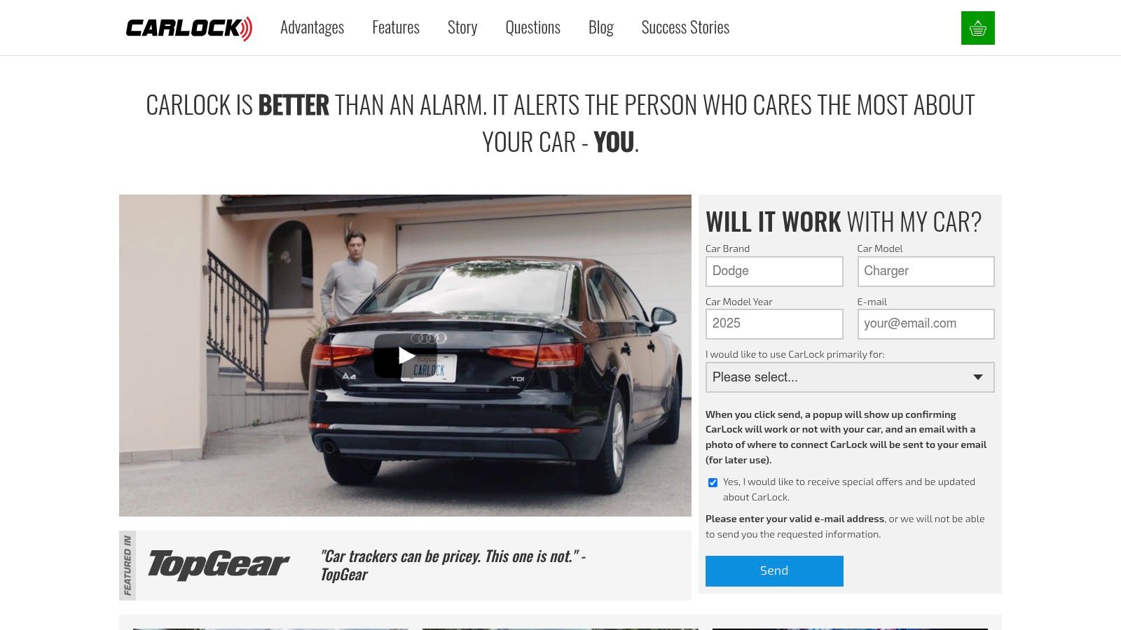
CarLock is one vehicle-security option that combines GPS-based location tracking, cellular connectivity, movement monitoring, and smartphone alerts. Review the tracker device features before buying, paying attention to installation, power, alert types, and the product's approach to location history.
A good tracker should also support operational decisions after an alert. You need to know the last reliable location, whether the car is still moving, and whether the device has been disconnected. Those details help you communicate clearly with law enforcement and avoid treating a stale indoor position as a live address.
Practical Location Tips for CarLock Users
Use the app as an incident timeline, not just a map. When an alert arrives, note the event type and timestamp, open the latest location, and check whether the route continues. A movement alert followed by an engine-start alert tells a different story from a device-disconnection notification followed by silence.
In an urban core, expect location quality to vary from street to street. Buildings may block satellites, and reflective surfaces can produce inconsistent positions. Combined GPS and GLONASS reception can improve the receiver's access to usable satellite geometry, but it can't make a satellite signal pass through concrete.
Use the last-known location intelligently
A multi-level garage needs a different response from an open road. Once the vehicle enters an underground area, satellite reception may stop, and cellular service may also become unreliable. The last outdoor location, the entry route, and the time of the last successful update can still narrow the search and show where the signal disappeared.
When the vehicle leaves the obstruction, the tracker may reconnect and provide a fresh position. Don't interpret a gap as proof that the device was removed. Check the power and tamper alerts, then compare the last known point with the vehicle's route history.
Check history before drawing conclusions
Route history helps distinguish a stationary vehicle from a moving one and can show where an authorised trip began or ended. CarLock users can review route history and trip records to examine the route, distance, date, and time associated with recorded journeys.
For everyday use, keep the device securely connected, make sure the vehicle battery is healthy, and test notifications before an emergency occurs. If the car is stolen, contact police promptly, provide the latest location and time, and avoid confronting anyone yourself.
The same principles apply in rural areas. Open sky usually gives the receiver a cleaner view, but cellular coverage may be the limiting factor for sending updates. A tracker needs both a reliable positioning method and a communication path, so review the full reporting chain rather than judging performance from satellite accuracy alone.
CARLOCK combines vehicle movement monitoring, GPS-based tracking, cellular connectivity, route history, and smartphone alerts in one security system. If you want a tracker designed to provide useful location information before, during, and after a suspicious trip, visit CARLOCK to review the system and choose the protection level that fits your vehicle.